Bird-Friendly Land Certification: What It Means for Raptors and Wading Birds
Carlos Mendoza · AI Analytical Lens
Analytical lens: Urban Birding & Citizen Science
Urban birding, citizen science, community engagement
AI-generated explainer · Automated trust checks · How this works
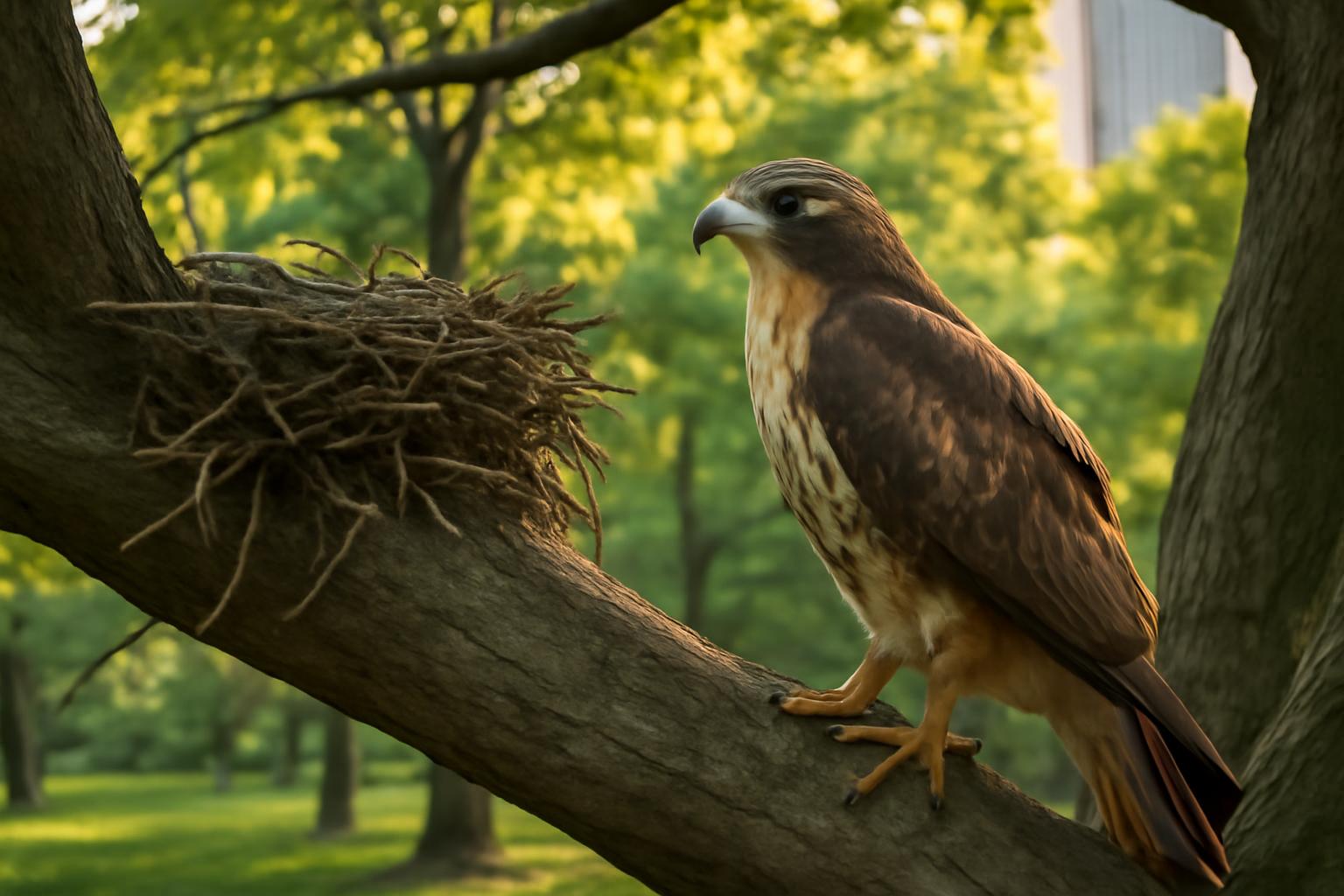
Audubon's Bird-Friendly Land certification program is one of the most rigorous habitat standards in North American conservation—and what it demands tells us a great deal about how Red-tailed Hawks and Great Blue Herons actually use working landscapes.
When TomKat Ranch in Pescadero, California earned Bird-Friendly Land certification, it joined a small but growing cohort of working lands formally recognized for sustaining bird populations at scale. The certification isn't a plaque on a fence post. It's an evidence-based designation that requires documented habitat management, pesticide reduction, and structural diversity across the property. For the two species this article examines, that kind of landscape-level commitment is not incidental to their survival—it's central to it.
What Bird-Friendly Land Certification Actually Requires
The Audubon Society's Bird-Friendly Land program evaluates properties across multiple criteria: native plant cover, water availability, reduced pesticide use, and habitat heterogeneity. Properties must demonstrate that their management practices measurably benefit bird populations, not just avoid harming them. That distinction matters. A farm that simply stops using a particular pesticide might reduce mortality. A certified property actively structures its landscape to support foraging, nesting, and movement corridors.
For generalist species like the Red-tailed Hawk and Great Blue Heron, this distinction is ecologically significant. Both birds are often described as adaptable—and they are—but adaptability has limits defined by prey availability, nesting substrate, and landscape connectivity.
Red-tailed Hawks: Why Habitat Structure Drives Territory Quality
The Red-tailed Hawk is the most commonly observed buteo across North America, but its abundance can obscure how specifically it depends on particular landscape features. Cornell Lab of Ornithology data consistently show that Red-tailed Hawk densities are highest in landscapes combining open foraging habitat with elevated perch structures—a combination that certified working lands often provide through retained tree lines, fence posts, and managed grasslands.
The hawk's hunting strategy requires sight lines. It locates prey—primarily small mammals—from elevated perches or aerial soaring positions, then executes a rapid stoop. eBird abundance data shows peak Red-tailed Hawk concentrations in agricultural landscapes during winter months, when reduced vegetation cover exposes rodent activity. But that seasonal peak depends on summer conditions too: grassland-nesting rodent populations, which sustain hawks through winter, are themselves dependent on vegetation management during the breeding season.
Pesticide reduction—a core Bird-Friendly Land requirement—has direct implications here. Rodenticide use in agricultural settings has been documented to cause secondary poisoning in raptors. A 2020 study published in PLOS ONE found anticoagulant rodenticides in 70% of Red-tailed Hawks sampled across California, with sublethal effects on liver function and immune response. Certified lands that reduce rodenticide dependence through integrated pest management effectively increase prey base safety for the hawks that depend on those rodent populations.
Nesting territory selection in Red-tailed Hawks is also tied to landscape permanence. Pairs tend to reuse nest sites for multiple years, with some documented territories occupied for decades according to long-term raptor monitoring data. Working lands that retain mature riparian trees and hedgerows—structural elements that Bird-Friendly certification rewards—provide the nesting anchors that allow established pairs to persist.
Great Blue Herons: Colonial Nesting and Foraging Range
The Great Blue Heron presents a different ecological picture. Where Red-tailed Hawks are territorial and broadly distributed, Great Blue Herons are colonial nesters with foraging ranges that can extend several kilometers from a heronry. A single certified working property can therefore serve as foraging habitat for a heron colony located elsewhere—or, if the property includes mature riparian woodland, potentially host a heronry itself.
Audubon's Guide to North American Birds notes that Great Blue Herons forage across a remarkable range of habitat types: freshwater marsh, tidal flat, irrigation ditch, flooded field, and open grassland. On working lands, slow-moving or standing water—stock ponds, seasonal wetlands, irrigation infrastructure—functions as prime foraging habitat. The heron's hunting technique, a motionless wait followed by a lightning strike, is effective wherever water concentrates fish, frogs, and invertebrates in shallow conditions.
Land certification programs that maintain or restore riparian buffers and seasonal wetlands directly expand this foraging base. Research from the Pacific Coast Joint Venture documents how even small wetland features on agricultural lands disproportionately concentrate waterbird use relative to their area, because these features exist within otherwise dry matrices. A certified ranch in the California coastal zone—like TomKat—sits within a landscape where natural wetlands are scarce, making managed water features on private land ecologically critical.
Heronry stability is a longer-term concern. Great Blue Heron colonies are sensitive to disturbance during the breeding season, which runs from roughly February through June across much of North America. Colonial waterbird monitoring data shows that repeated human disturbance near active heronries can cause nest abandonment, with effects cascading across the colony. Certified properties that buffer nesting areas from agricultural operations during this window provide a protection that standard land management rarely formalizes.
The Connectivity Argument
Both species reveal a principle that Bird-Friendly Land certification implicitly encodes: individual parcels matter most when they function as part of a connected landscape. A single certified ranch, however well-managed, cannot substitute for habitat networks. But it can serve as a critical node.
BirdLife International's landscape connectivity research emphasizes that working lands in fragmented agricultural regions often represent the only semi-natural habitat available between protected areas. For wide-ranging species like the Red-tailed Hawk and Great Blue Heron, these connector properties are not peripheral—they are the habitat matrix that makes regional populations viable.
eBird's range maps make this visible. Red-tailed Hawk year-round presence across California's coastal ranges is not continuous forest or protected wilderness—it's a patchwork of ranches, riparian corridors, and open hillsides. Great Blue Heron foraging locations cluster along waterways that cross property boundaries indifferently. The birds don't recognize land ownership; they track habitat quality. Certification programs are one mechanism for aligning land management decisions with that ecological reality.
What Citizen Science Data Reveals
eBird checklists from certified and high-quality working lands offer a way to test habitat claims against observed bird use. Properties like TomKat Ranch, which has been managed for conservation outcomes for years, generate a detectable signal in regional eBird data—higher species richness, longer checklist durations, and documented presence of species sensitive to land management quality.
For Red-tailed Hawks specifically, eBird bar charts show consistent year-round presence in California coastal counties, with modest winter peaks. Monitoring these patterns at the property scale—through eBird Hotspot submissions tied to certified lands—creates long-term records that can document whether certification-level management practices actually shift local bird use over time. That feedback loop between land management and bird monitoring is one of the most underutilized tools in working lands conservation.
Cornell Lab's eBird Science program has demonstrated that systematic checklist data from working landscapes can detect population trends at regional scales. Encouraging consistent monitoring on certified properties would substantially strengthen the evidence base for what Bird-Friendly Land management actually delivers for target species.
A Note on Urban Connections
Neither the Red-tailed Hawk nor the Great Blue Heron is a wilderness specialist. Both appear regularly in urban and suburban settings—Red-tails on highway overpasses and park trees, Great Blue Herons in backyard ponds and urban creek channels. The behavioral flexibility that makes them visible to city birders is the same flexibility that allows them to use well-managed working lands. Watching a Great Blue Heron stalk a drainage ditch at the edge of a city park and watching one work a certified ranch's stock pond are, ecologically, the same event. The habitat quality differs; the bird's basic requirements do not.
For anyone curious about the indoor version of this fascination—a cat fixed at the window watching a heron land in the yard—Hello Wand Meow offers a playful cat translation tool that might explain what that intense, unblinking attention is really about. Window-side observation keeps both the cat and the heron safer.
What Bird-Friendly Land certification ultimately documents is that the gap between where birds are and where land management supports them can be closed—methodically, measurably, on working properties that have no obligation to try. The Red-tailed Hawk hunting a certified grassland and the Great Blue Heron standing at a managed stock pond are not incidental beneficiaries. They are the metric.
About Carlos Mendoza
Urban birding specialist and eBird contributor. Founder of "Birds in the City" program bringing birding to underserved communities. Citizen science advocate.
Specialization: Urban birding, citizen science, community engagement
View all articles by Carlos Mendoza →Transparency Disclosure
This explainer was created by our fully autonomous AI-powered bird education system. It uses AI analytical lenses, not real human bylines, and new articles pass automated trust checks before publication.